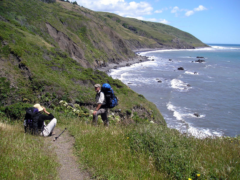
The Lost Coast of California, Leslie Warren photographs Paul Morgan.
Hike the Lost Coast of California
In northern California south of Eureka, between Petrolia and Shelter Cove there is a 24 mile long stretch of beach that is inaccessible to motor vehicles, it is known as "The Lost Coast."
The Lost Coast of California, Leslie Warren photographs Paul
Morgan.
My friend Paul Morgan invited me to join him and Leslie Warren, the director of the Placer Nature Center, on a backpack trip along the Lost Coast. I'd done it twice before with my wife, Ellen, and really enjoyed the trip so I said yes. We spent one full day driving up from San Francisco placing my car at the north end and then driving to the south end to start our hike. (It took us six hours to drive from Mountain View to the turnoff from 101 to Petrolia, and then an hour and fifteen minutes to drive to the parking lot at the mouth of the Mattole River.)
After placing my car, we took the shortcut road from Honeydew to Shelter Cove. There were two choices a longer paved route and a "shortcut" dirt road. The locals warned us about the dirt road but we took it anyway. It was slow rough going with fords and ruts and washouts. At one point the car started making scraping noises, I got out and removed branches that had become tangled in the undercarriage.(It took an hour and a half to drive this road.) Later we took the paved road and although it was longer it was faster to drive, still taking about an hour and a half from the mouth of the Mattole to the Black Sand Beach trailhead parking near Shelter Cove.
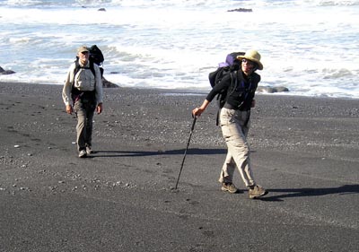
It was 7 PM before we were packed and ready to go, We hit the beach hiking and went for an hour and a half before the sun set and we made camp. I had a surprise extra hiker on the trip, Cole, Leslie's dog. Dogs are allowed on the beach hike. Cole was bouncing with enthusiasm as we started.
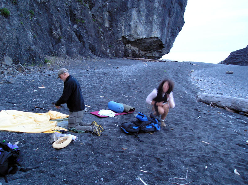
Beach camp the first night. Watch the high tide line.
I had done my research and looked up the tide tables. It was a new moon so the high tide was going to be very high and the low tide very low. We set up camp several feet above the level of the marks of the previous day's high tide.
I also found out that the Kings Range Conservation Area now requires backpackers to carry bear cans with them on the hike. They require 1 can per person. Luckily I own a bear can for my many sierra treks, the ranger station also rents them. (As does the Petrolia store.)
We had dinner under the stars and got to bed before 11 PM.
5 A.M. time to get up. It was just barely bright enough to see but we needed an early start to be able to hike past some cliffs that the arriving high tide would make impassable.
The beach provided great entertainment as it always does.
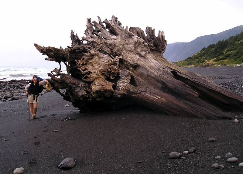
Driftwood littered the beach.
The tallest trees on earth are upstream from the Lost Coast so it's not surprising that giant logs litter the beach.
It was the end of May after a rainy winter so I expected that the streams that we would have to cross would be running fast. I was right. As my one luxury item I brought a pair of lightweight sneakers to wear while doing stream crossings. On one crossing we found a good log bridge across a stream.
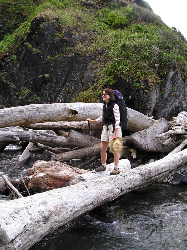
The springtime stream crossings were always exciting.
As we hiked we looked for things washed up on the beach. We found two large octopi. Their legs had been eaten off, but their eyes were still intact. We examined their suction cups and turned them over to look for their beaks, which had also been eaten.
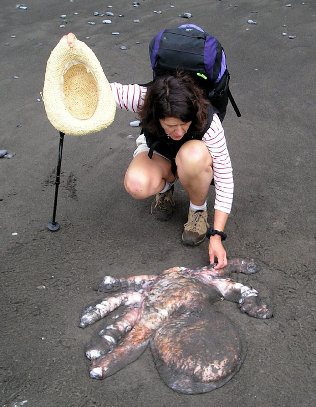
A large chewed-up octopus was on the beach.
In one region the streams were rich in dissolved calcium carbonate. The water flowed through sand and gravel and turned it into limestone-cemented rock. The water flowed over grass and plants and turned them to stone as well. We came upon one large boulder that was almost entirely travertine, it stood out white against the surrounding rock.
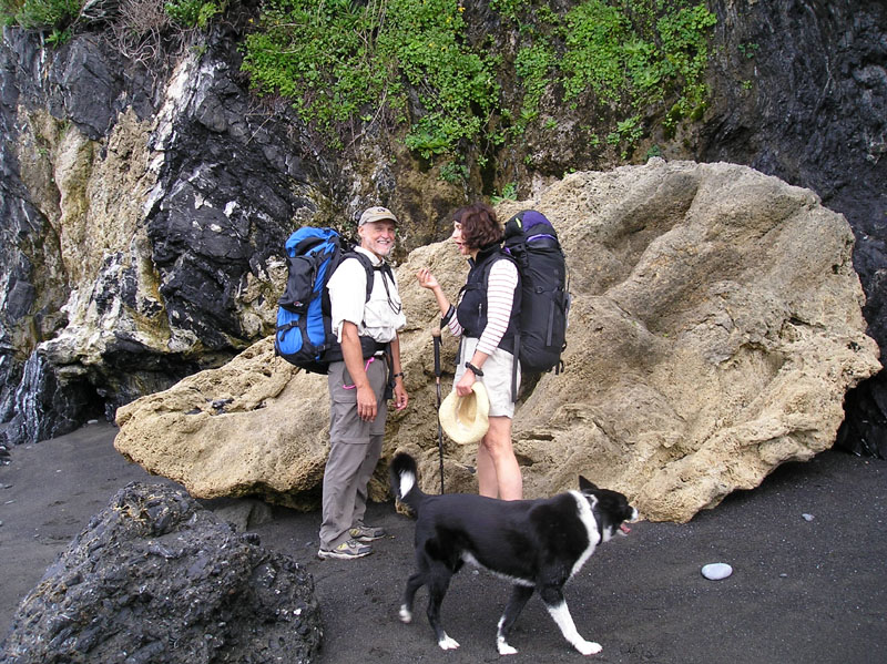
Paul Leslie and Cole stop near a travertine boulder.
At the white boulder we had reached a stretch of beach where the high tide above +4 feet washes up against a steep cliff, there was no easy was to go inland to bypass this section. I pushed our crew hard hour after hour with a few stops to look into tidepools and to snack so that we could make it past this area with allow enough tide. Thanks to hard walking by all we made it! Beyond the tide-door the beach opened out again, we could afford to walk in a more leisurely fashion and stop to smell the kelp. We had reached the wide outwash plains of Big Flat.
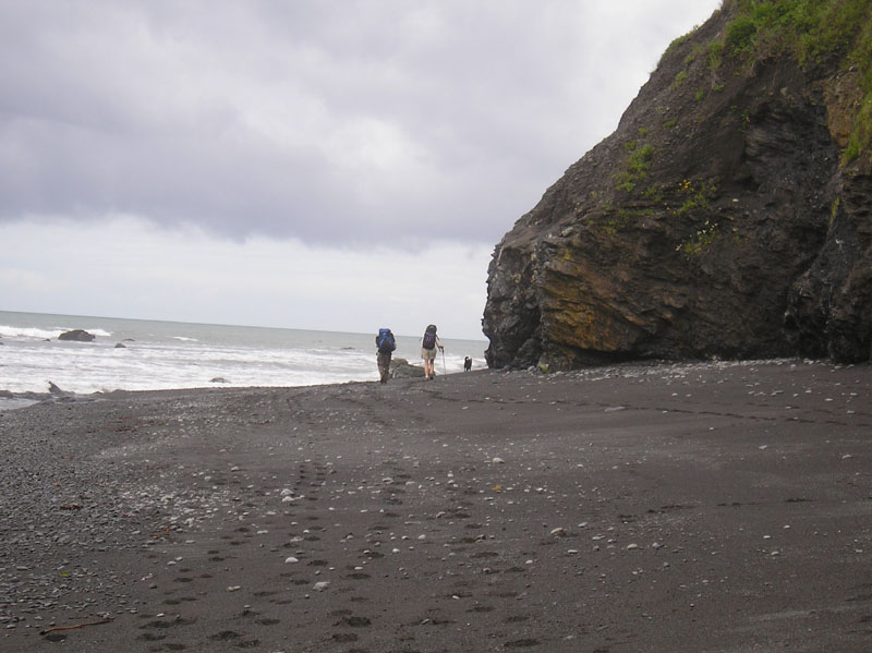
Walking down the beach between the incoming tide and the
cliffs.
We made it to Spanish Flat after 11 hours of hiking, quite a day, we covered about 10 miles along the beach. Cole the dog traveled much farther than we did as he explored every smell along the way. I was glad to see that he was doing well even though his feet were a little sore. We found a wonderful shelter made of driftwood which blocked the north wind. We set up our tents, gathered driftwood for a fire, and created a kitchen in which to cook dinner.
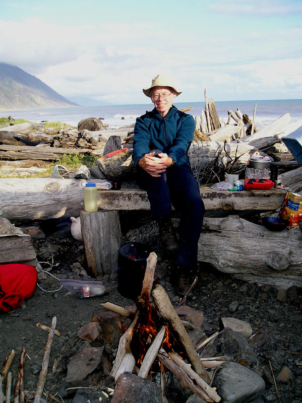
Proof that I actually came on this trip! Leslie built the driftwood
fire, I'm heating water on the stove for dinner.
Just as we finished dinner a band of heavy rainshowers swept down the coast and chased us into our tents. This was one reason that I had brought tents instead of bivy sacks for this coastal hike. A tent is a much more comfortable place to wait out a rainshower. As we quickly stuffed our food into our bear can we missed putting away the chocolate coated almonds...the local rodents enjoyed a wonderful treat at our expense.
I thought we could sleep in until 5:30 the next morning, it turns out that later in the day I would find out that I was wrong!
In the rainstorm our fire lighter got wt and would not start. Somehow in our packing at the trailhead all of our backup matches had been left behind. So we had to wait a half hour for the lighter to dry before we could start the stove to make breakfast.
As soon as we started I found some great rocks to climb, near some tidepools to explore. A good start to any day.
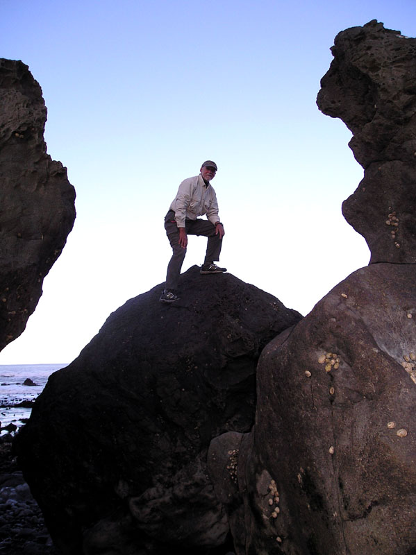
Paul Morgan tries out the beach boulders.
It was a great day for hiking on the beach.
Alas, we arrived at the next tide-door too late. The tide was already hard up against the cliff. I looked around and didn't see the inland hiking route (which I later spotted on the other side.) so I took us up and over the boulder field.
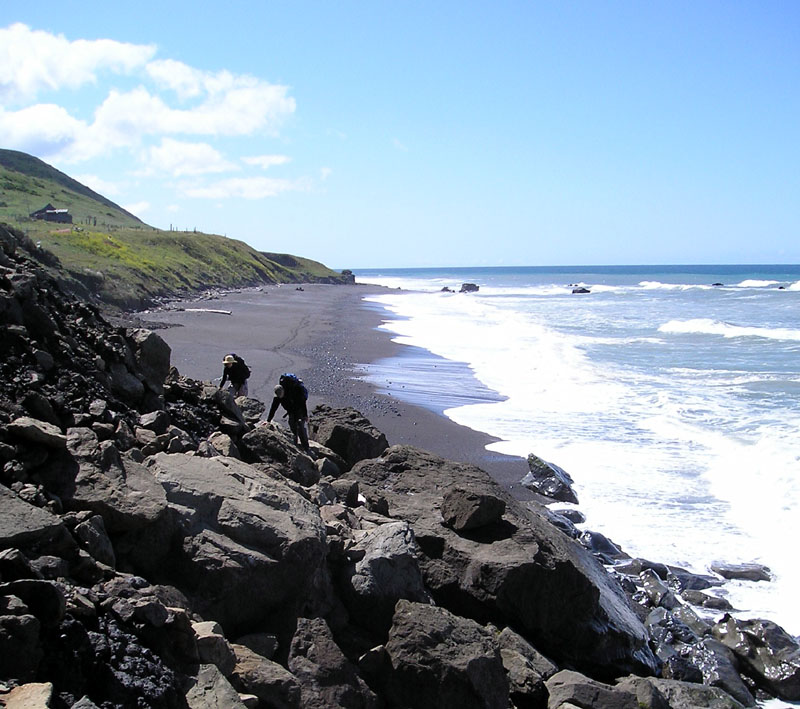
Climbing over the boulders to avoid the waves.
Leslie found the boulder climbing to be very exciting. So that when we made it over the difficult section she kissed-the-earth by taking off her pack and collapsing onto the ground. Since we were home free now I decided to declare a rest period of 3 hours while we ate lunch and recovered.
After our rest the tide was still high so we followed the optional inland route.
See the first photo at the beginning of this article.
The inland route was higher than the beach route and gave us views of sea lions basking on offshore rocks.
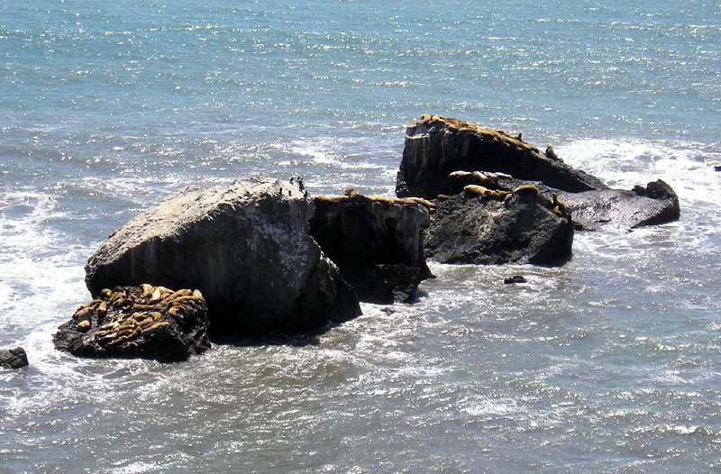
Sea Lions on the rocks.
We had a good hike during the afternoon and found another campsite above the high tide line with a windbreak for the kitchen. Cole had sore feet after two long days of hiking so he ate his dinner and curled up to rest.
We only had two miles to go so we slept in until 6 AM the next morning. We were hiking toward the car by 7 A.M. The tide was really low so we had great tidepools.
I found a neat rock and had to stand on it!
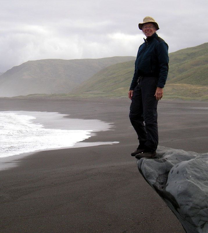
I love climbing rocks! Even on the beach.
We got to the car by 8:30 A.M.
It is a fun beach hike.
I recommend it to every backpacker, but remember to go with the flow of the tides.
|
Scientific Explorations with Paul Doherty |
|
1 June 2006 |