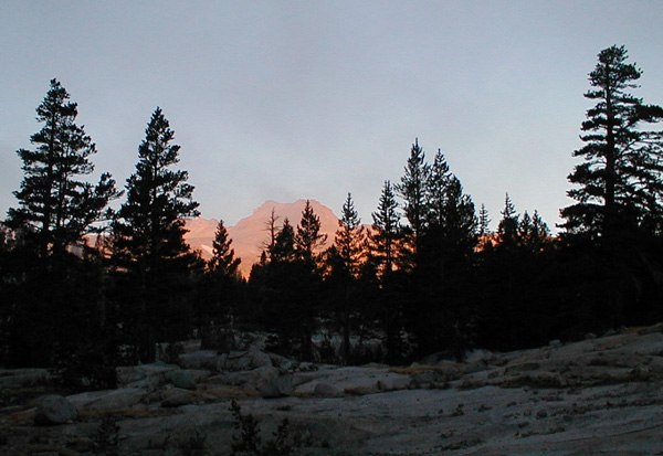
Cirrus bands trailing virga swept across the sky. What did it presage?
An Adventure on the Sierra High Route with Paul Morgan
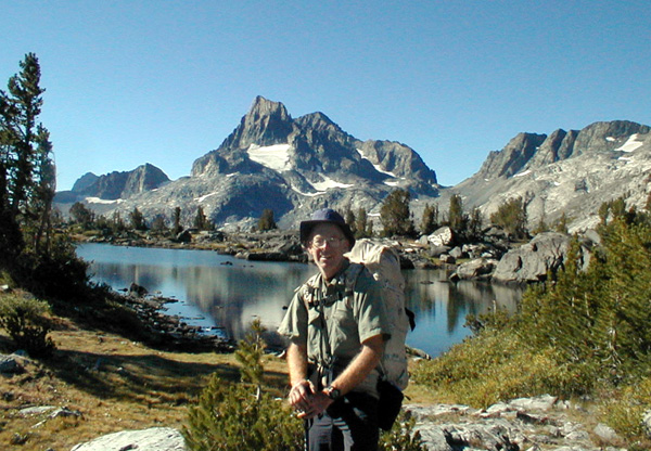
I tempted Paul Morgan to come to California by promising him a backpack on the Sierra High Route plus an opportunity to climb Mount Lyell, the highest summit in Yosemite National Park. Paul made a short stop in Montana on his way to the Sierra to run a 50 km ultramarathon to warm up for my trip. He won the trophy since he was the first man over 60 years old to finish the race. (He was also the only man over 60 in the race, that's not a complaint, I'm under 60 and I couldn't have finished the race.)
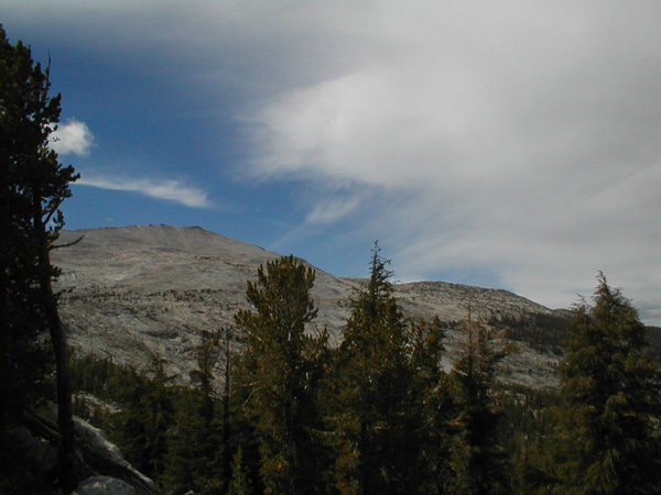
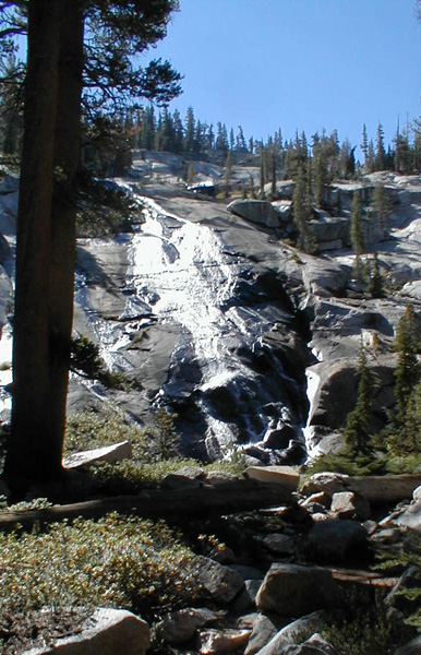
We picked up our permit which I had reserved ahead of time then drove to the trailhead for the John Muir Trail. We stuffed all of the food from the car into a bear box. Then we shouldered our 39 pound packs which contained 5 days worth of food and started hiking at 8:30 AM. The trail followed the Lyell fork of the Tuolumne River. It ran level for many miles. Paul and I told stories of our recent adventures as we traveled alongside the clear waters of the Lyell fork. The conversations slowed down as we followed the trail uphill. As we climbed we encountered the trail crew, they were doing hard work splitting rocks and using the broken rocks to surface the trail so that it could withstand the heavy use by hikers and horses. Strange north-south bands of thick cirrus clouds blew across the sky from the west, I'd never seen such a weather pattern in the summer before and wondered what it meant.
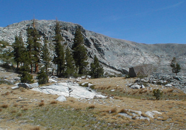
When the trail made the last crossing of the Lyell fork and headed toward Donahue pass we stopped and set up camp. It was 3:45 and we were at 10,300 feet. We ate dinner and went to bed as the sun set. We both had been working hard to get away for this trip and 12 hours of sleep seemed like a good idea.
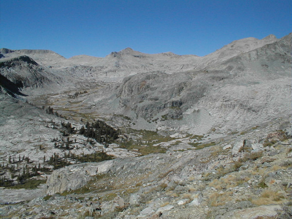
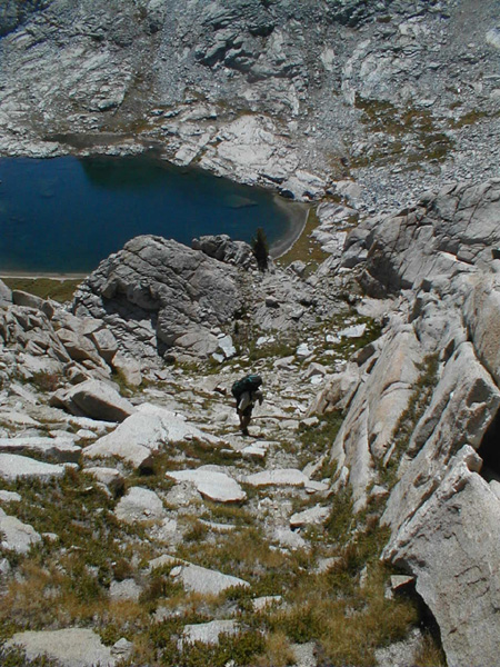
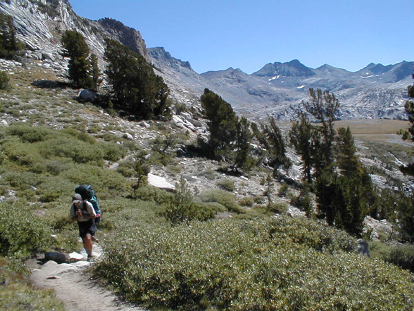
We were up at dawn, ate quickly and left camp at 7AM on our way to Lyell. Shortly after we started a group of three climbers from Pennsylvania passed us. We'd meet them again soon. The trailess hike toward Lyell was a wonderland of glacially eroded granite. Short cliff bands rose over flat grassy areas. Every sort of glacial erosion was visible, moraines, chatter marks, glacier polish and chatter marks to name a few.
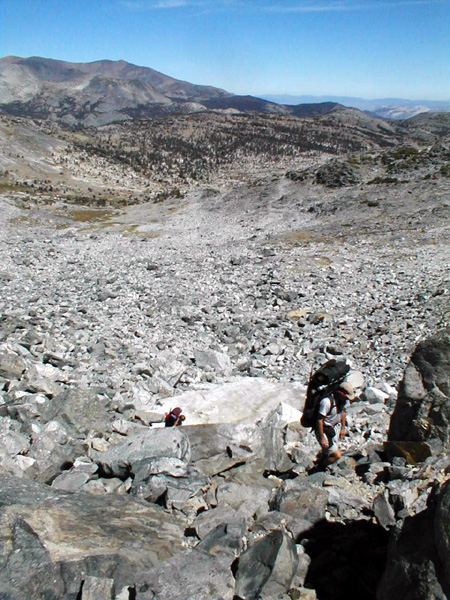
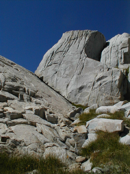
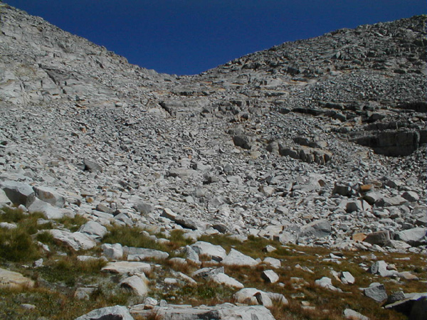
Soon however the going got steep. we threaded out way up class 2 walking, still on good granite. When the ongoing got steep we managed to pass the Pennsylvania group, they were feeling the altitude, it was their first 13,000 foot peak. They were equipped as I had been on my first trip to this peak, ice axe crampons, climbing shoes, rope and rack, but this time I knew Lyell so Paul and I brought only our climbing shoes. Soon we reached the moraine band that surrounds Lyell. For the next few hours we would be hiking on somewhat loose talus blocks.
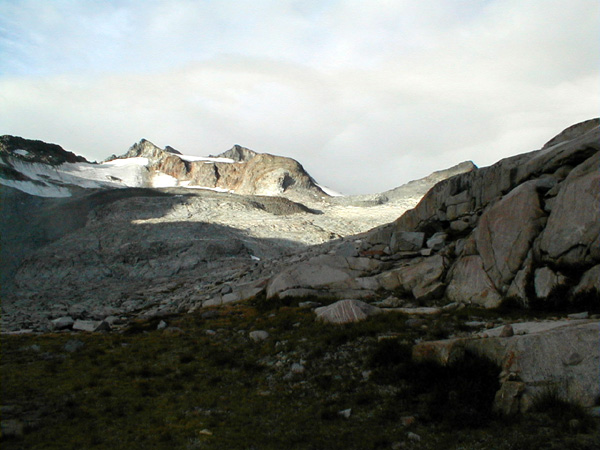
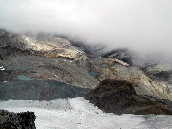
Eventually we reached the Lyell glacier. The day had turned overcast and cloudy. It was unseasonably cold too. I stepped on the glacier and found it was hard ice. The Pennsylvanians had an advantage with their crampons now. Paul and I had to go the long way to the summit climb via rock instead of glacier. The last time I was on Lyell it was sunny and warm and it was easy to kick steps up the glacier.
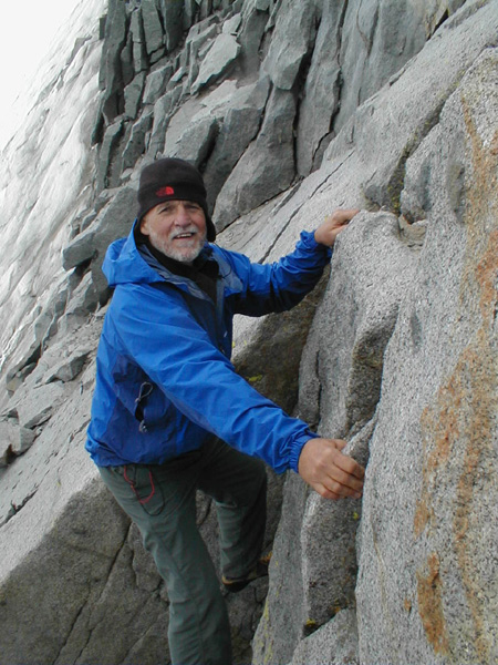
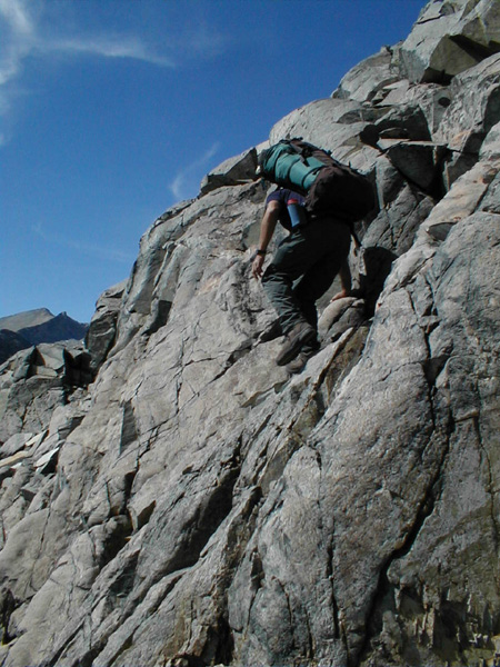
When we arrived at the base of the summit climb on Lyell I joked with the Pennsylvania group. I mentioned that I was pulling my "courage from my rucksack" as I took out my climbing shoes and put them on. I guided Paul through the free solo climbing up the easy 5'th class moves to the ridge on Lyell. It is a spectacular climb. Good solid rock moves with not too much exposure heading toward a high summit. As we climbed the ridge, just a few feet away the wind roared at 40 mph or more, but the cliffs deflected the wind over our heads so we climbed in calm air. We reached the 13,100 foot high summit by 11 AM. The clouds raced over our heads just a few feet away. So the views were not great. But we were happy to be on the top.
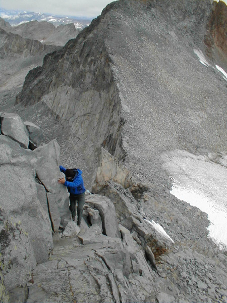
Fun climbing along the ridge of Lyell.
We descended past the Pennsylvania climbers who were happy to be approaching the summit. We made good speed down over the talus, back toward camp. I was really glad that I had turned around and memorized the route back down the mountain as we climbed up. It is a big complicated mountain, and there are cliffs that block the descent which are easy to see from below but hard to see from above.
Our day was not over. We had to pack up camp and head over Donahue pass toward Thousand Island Lake. But the weather was deteriorating. It was cold, windy, and spitting rain. It felt like a winter storm from the gulf of Alaska. I was a bit worried about the weather forecast. But we left camp at 2:45 heading uphill. We crested the pass in sprinkles at 3:30 and headed down.
Along the gently descending Muir trail, we met two biologists with nets sticking out of their packs, they were searching for yellow-legged frogs. They reported a healthy population which was good news. They also told us that this was a storm from the gulf of Alaska and that they heard it was going to snow for the next three days. That made me worry. I had a tent with us so that we could survive a storm, but I didn't want to get pinned down by a blizzard off trail on the high route. We decided that we'd see what the weather was like tomorrow morning before we left the trail. As we hiked, the weather deteriorated even further so we decided to stop early at a nice sheltered campsite. It was 5:30 and we were still an hour from Thousand Island Lake. The shelter from the cold wind and rain provided by the trees was welcome. We had a warm comfortable sleep in the tent.
The morning dawned with a strange fog. The cold wet air trapped in the valleys created condensation which broke up as the sun rose and blew away to the west. The sky above looked clear so we decided to take our chances and press onward. We left camp at 8 AM.
It was the right decision. The day turned beautiful, bright sunny clear and calm.
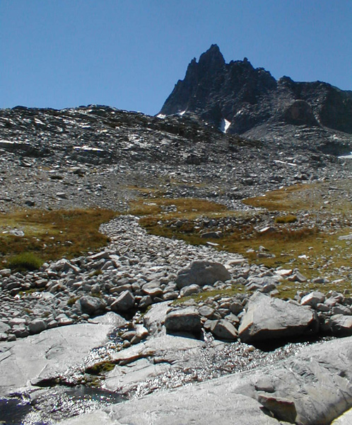
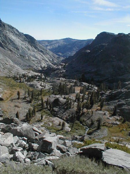
We left the Muir trail at the high tarns and headed for the west end of Thousand Island Lake. It was beautiful country to walk through off trail. Granite and grass with scattered trees and a blue jewel of a lake spotted with white granite islands. We soon headed up the inlet stream following a faint trail toward North Glacier Pass.
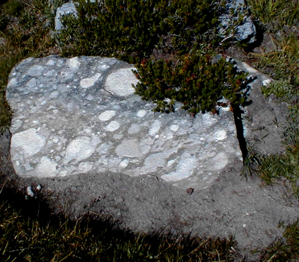
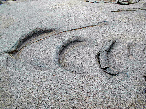
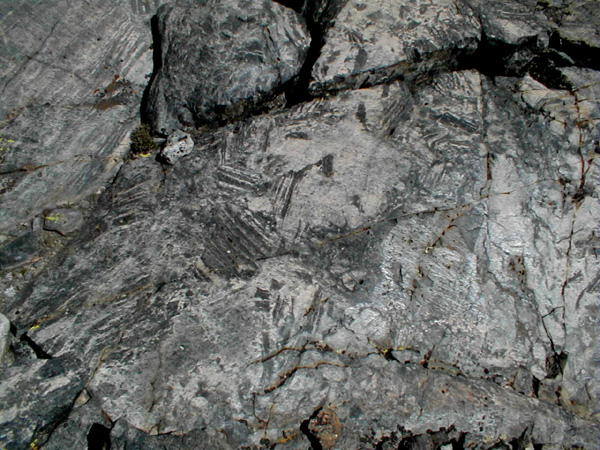
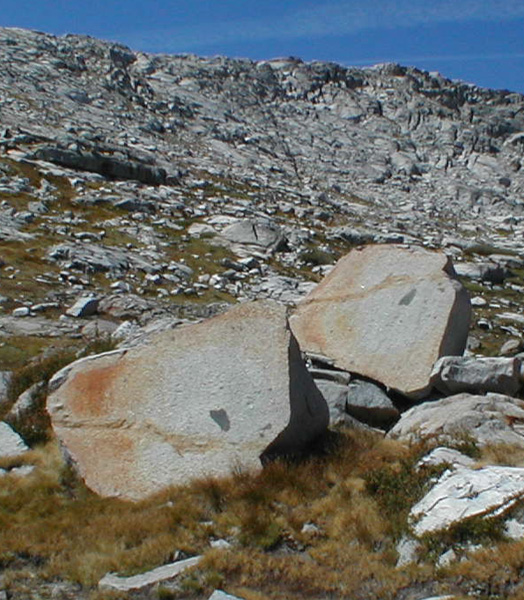
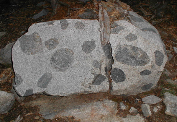
A rock with many white "eyes" on the route above Thousand Island
lake.
As we gained our first look at the pass we could see that it was defended by an extensive field of talus. Just as we were to step onto the talus a couple of climbers caught up with us, Vicky and Tom. They were also doing the high route. They were faster than Paul and I on trail, but we were slightly faster when the going got bad. I headed right toward a moraine, the talus blocks were stable, a blessing after the climb of Lyell, but they were rather large so I called back to Vicky and suggested that they follow a different route. They went up the center of the talus field and found it better. After looking down from the top we all wondered if the best route of all is on the (climbers) left of the talus field.
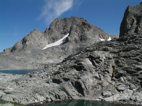
The talus ate up our time and so we reached the 11,000 foot pass at 12:40 PM. It was too late for us to climb Banner Peak. So we ate lunch overlooking Lake Catherine.
The descent from North Glacier Pass was interesting. Looking back on it I'm impressed by Steve Roper's route finding ability. He not only had to find a route that he could do safely, he had to find a route that generations of hikers could find and then follow safely. That is a much harder job. But I think he did it well. Our two groups had no trouble finding and following a safe route down the steep granite.
From Lake Catherine we descended a steep wall down into the valley of the North Fork of the San Joaquin river. We climbed over rocks, down next to waterfalls, along grassy ledges. Always descending.
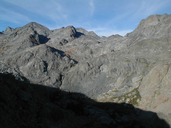
The rock continued to be interesting. This was not uniform igneous rock, it contained great swaths of metamorphic rock as well.
We hiked down toward the canyon of the North Fork of the San Joaquin, a remote and beautiful part of the Sierra.
We stayed as high as we could above the San Joaqin canyon, then headed uphill toward North Twin Island Lake. The hiking along this section was so nice we quickly arrived at the lake and approached its outlet. Roper indicates that crossing the outlet requires a 20 foot long three foot deep wade. However this late in the season we were able to rock hop our way across the river.
There is a small clump of trees at the south end of South Twin Island lake. There were two hikers in the campsite among the trees. They were taking 8 days to do the same route we were covering in five. I told Paul not to listen to them, since I knew that he didn't like "Rest Days." We pushed on a little beyond the lake until we came to a campsite near a dead tree with a fantastic view down the San Joaquin.
When we set up camp at 6 PM the weather was warm and calm. A few breezes gusted past us during dinner. As dinner ended, one large gust picked up my sleeping bag and blew away my therm-a-rest mattress. I ran after it down the cliff bands and found it quickly. Whew. This time I weighed it down with very large rocks. There were no more gusts.
In the morning we were on the trail by 7:30 AM. We hiked around a mountain spur and up a grassy valley toward a lake. During the night the barometric pressure had changed and I didn't notice so I navigated us to a point a few hundred feet above our target lake. Our extra climbing effort got us a good view of the lake and the country beyond which we would soon be crossing.
When we arrived at the lake Tom and Vicky were drying their sleeping bags in the sun. We said hello, then pushed on. Roper says that many parties become lost in this section. But Paul and I did not. Roper's instructions were clear and easy to follow. Before we descended into Bench Canyon we got a view into our future, we could see all the way to lunch. We made our way down grassy and brushy slopes into the wonderful Bench Canyon.
Here the stream flowed across bare granite. There were small clusters of trees and some wonderful bouldering rocks.
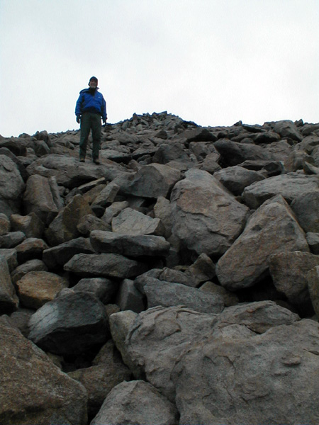
Bench Canyon gave us easy walking through gently rising grassy meadows. Small clusters of trees beckoned us to camp in them and boulders called me to climb them. I succumbed to their calls.
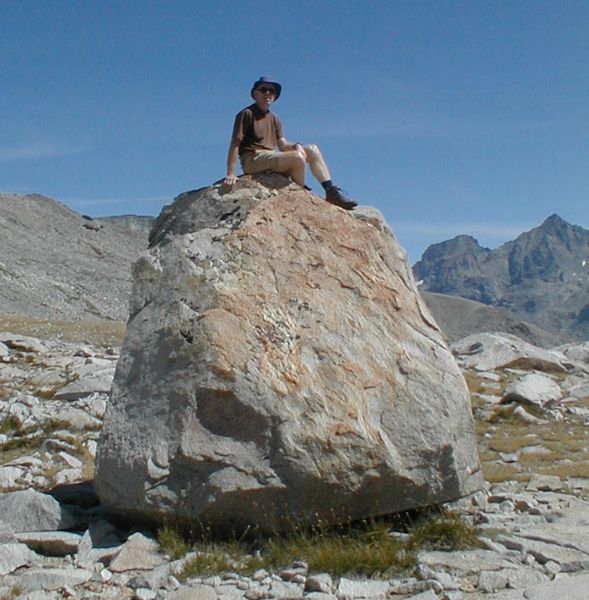
I couldn't resist and had to climb the boulders. Paul
Doherty.
We hiked up canyon next to the stream enjoying the views. Our next obstacle was Blue Lake Pass, another 11,000 foot pass. We had to get over it and down to the trails leading us back to our car. We climbed upward on easy ground to Blue lake where we stopped for lunch.
Then chose a route up grassy chutes to the right of the pass to reach the pass by 1:45 PM.
Along the way we had a chance to do a layback climb under full pack.
But we decided to continue up the grassy slopes instead. The view from the pass was fantastic. Although there appeared to be cliffs blocking the descent. Roper said we could pass the cliffs on the right. He was correct. We soon found ourselves down the talus slope and onto easy walking.
We hiked across flat terrain and into the woods aiming for the Isberg Pass trail. I had entered many waypoints into my GPS in case clouds or fog obscured our route, but I had never needed to use them. In the tress however I worried that I had missed the trail which Roper calls little used and hard to find. I pulled out the GPS and it indicated that I had not crossed the trail With my confidence restored we hiked on, and found the trail marked by fresh horseshoe prints. We hiked down into the Canyon of the Merced River and soon found a nice campsite. It was 5:15 PM. Tomorrow would be a long day. We had 18 miles of trail between us and the car. Then a long drive home. As we ate dinner we heard strange noises. It was Vicky and Tom calling out to avoid encountering bears. They jumped in surprise when I said hello. They camped near us tomorrow they planned a rest day.
We got an Early start leaving camp at 6 AM. We hiked gently uphill for miles along a wonderful granite ledge and eventually lost precious altitude by descending into a canyon. We went down to 8000 feet.
We turned up the canyon following the trail toward Vogelsang pass, a pass almost 11,000 feet high. Thank goodness it was beautiful country with streams running across granite, the views helped the uphill miles pass pleasantly.
We got into a steady uphill rhythm and we were surprised to arrive at the pass shortly after noon. We didn't stop but pushed on toward Vogelsang High Sierra camp where I purchased a candy bar to eke out our dwindling food supply. Shortly after the camp we stopped for lunch.
The trail we took down to the car was the same trail that people take up to the high sierra camp. We passed over 50 people heading uphill. We made good speed and arrived at the car by 4:16 PM. I had promised Paul at the beginning of the trip that we would return to the car by 4PM I brought us in just a quarter of an hour late after traveling 50 miles on trail and off across fantastic country. A good trip.
|
Scientific Explorations with Paul Doherty |
|
18 Sep 2003 |