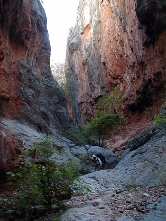
Chris Hibbert canyoneering down Saddle Canyon.
Chris Hibbert canyoneering down Saddle Canyon.
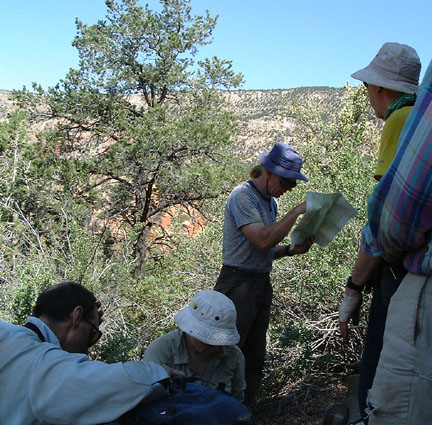
Bob Ayers proposed a trip: On the north rim of the Grand Canyon, to Canyoneer down Saddle Canyon from Mauv Saddle then travel across country across Tapeats Amphitheater and up the cliff between to Crazy Jug and Monument Points. Since the last Grand Canyon trip that Bob ran was one of the best backpacking trips I have ever been on, I signed on in a flash. I knew this was going to be an adventure. And I was right!
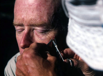
On the rim the night before we started I needed medical attention. Martin acting as chief surgeon had to remove 8 stitches from my face. I had acquired the stitches in a bicycle accident. My doctor, John Cranshaw, provided me with the tools, and Martin did a superb job slipping the cords out of my face.
Now I was ready to hike.
Sleeping outside the night before we started our hike, the night of the full moon, I dreamed strange dreams of Sirens singing entrancing music. Then I woke up to hear the songs of coyotes quite close to us. Wild wonderful sounds.
Click on the Thumbnail images to see them enlarged.
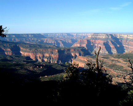
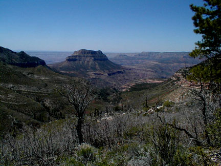
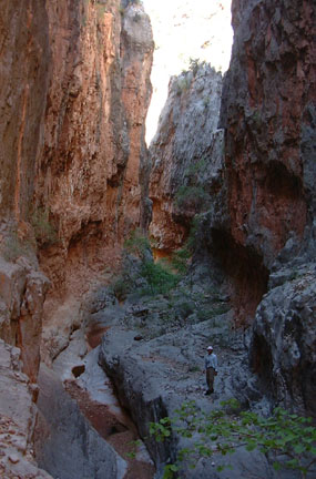
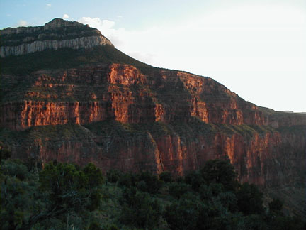
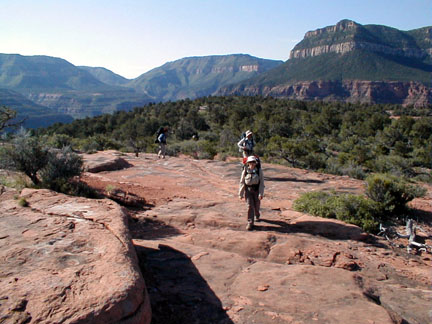
The Grand Canyon. A tough place to hike off trail, but a
place with scenery that rewards those who go on
adventures. Here is the view from Monument point on
the North Rim of the Grand Canyon. We drove out Fire Point until the road
vanished into a mud puddle then pulled over on a side road
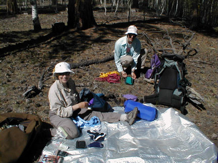
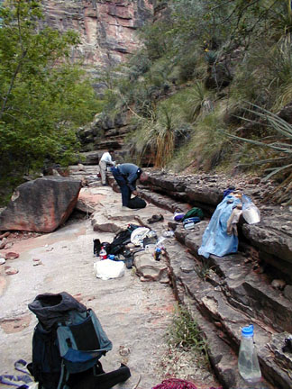
and set up camp. We packed food for tomorrow's departure.
We used precision brass scales to keep
everyone's personal pack gear under 24 pounds. We each also
carried 3.5 pounds of group gear, 10 pounds of food, and 6
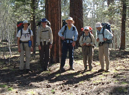
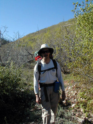
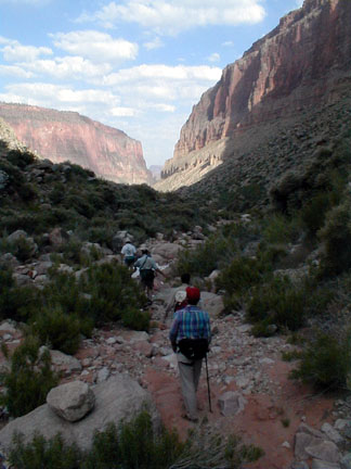
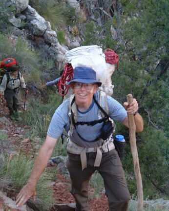
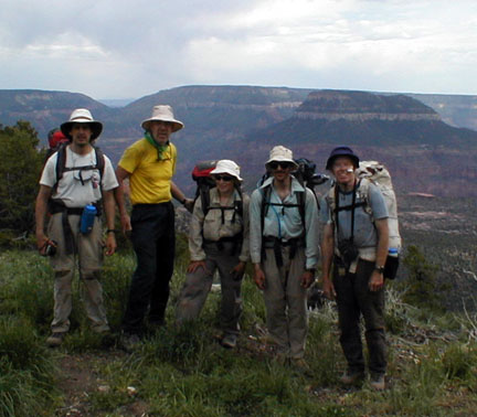
pounds of water. So the packs totaled 44 pounds. In the morning, Six of us were ready to
go: Left to right: Chris Hibbert, Paul
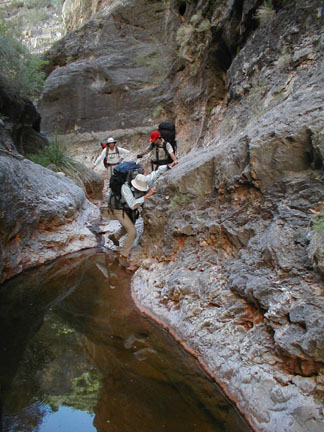
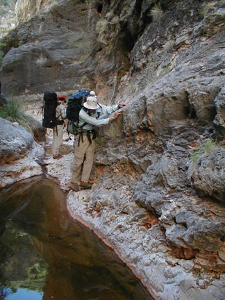
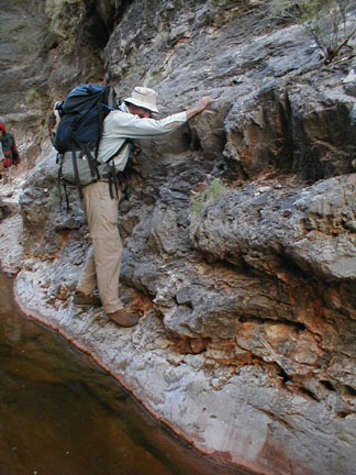
Doherty, Bob Ayers, Morresa and Martin Meyer, Photo by Bill R. We set off hiking due south toward Swamp
Point. Our route crossed five deep gullies. There was still
snow in the gullies! Thorn bushes blocked our route in places,
giving us a taste of the future. Thank goodness Bob and Chris had scouted
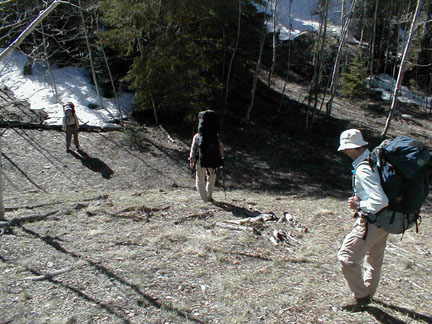
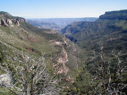
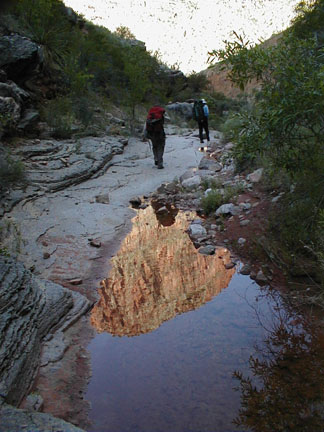
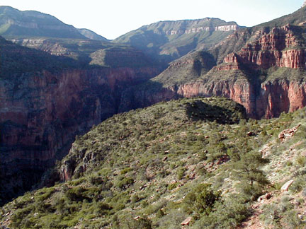
the trail the day before. Our Route viewed from Swamp Point.
The view from Swamp Point is one of the
best in the Canyon. We're heading to the distant rim right of
the isolated summit named Steamboat Island. The descent to Mauve Saddle was on a fine
trail: The North Bass Trail. Half an hour brought us down to Mauv
Saddle. As we hiked down, we had a big shock. We
looked up at the ridge where our cars were parked and saw a
forest fire. Later we learned that the Forrest service
spotted the fire two days later! In the larger photo you can see the smoke
against the sky just right of center. You can also see why we crossed this
canyon miles upstream, steep cliffs! Hiking down to Mauv Saddle we got this
view of the North Bass trail. The right edge is part of the Powell
plateau. I hoped to be able to make a quick visit to the
plateau, but the backpacking took long enough that we didn't
have time. We arrived at camp at 2:30. Then went off
immediately in search of water. We went a few hundred feet down the north
Bass trail below Mauv saddle to reach a spring. It was
flowing about a liter a minute. A fine spring! Particularly
fine since it meant we didn't have to hike back up to the
Swamp Point road and sip water from mud puddles. On the way to the spring we passed these
stalagmites of greenery formed around seeps, where water
drips from the roof of an overhang above the North Bass
Trail. The water is full of minerals which coats the moss
and turns it to stone. Then more moss grows on the new
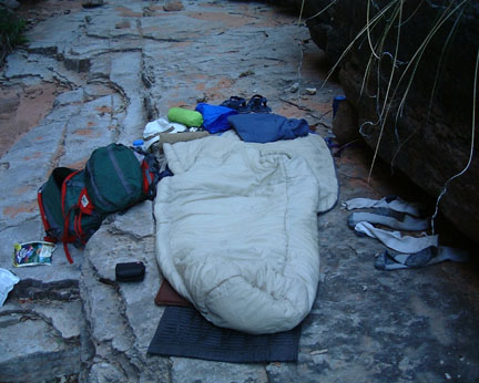
stone. Camp 1 at Mauv Saddle. We camped next to
a beautifully maintained cabin. Before we left camp Bob gave everyone one
last chance to turn back. Bob Ayers has a scale on which he
measures bushwhacks, The logarithm of the number of cuts per
person. By the end of the first day most people were rated 1
on this scale with ten thorn punctures apiece. I was proud
of my single puncture giving me a 0. By the end of the trip
no one had reached 2. Traveling through the brush was greatly
helped by finesse. Gently pushing thorn bushes to the side
and slipping past them uses far less energy than pushing
through the thorns. A short stick also helps push the thorns
aside. We wore long pants and shirts to help
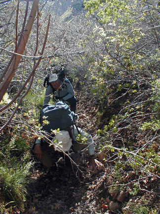
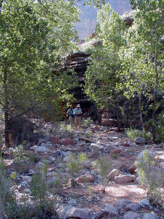
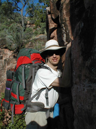
protect our flesh from the brush. Here is Chris during a brief respite from
bushwhacking. As we hiked down, we hiked from the bushy
climate zone into the desert, it was a great improvement.
Widely spaced agave and cactus were easier to avoid than
interlocked thorn trees. At one point the canyon was blocked by an
ancient landslide which turned the river to one side and
carved a great cool canyon. A trail snaked over the
landslide in the heat of the sun. We dropped our packs and
sent Martin ahead to explore the canyon route. He returned
smiling and said the route would be fun. Fun was why we were
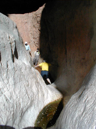
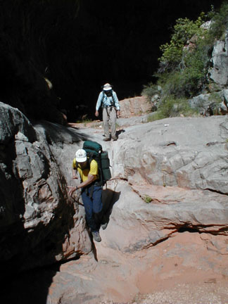
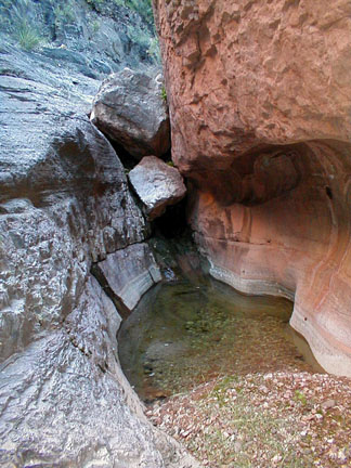
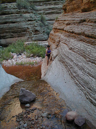
here, so we decided to do the narrows. We started getting ready by taking off
our hiking boots and putting on our water shoes. I wondered how deep the pools would
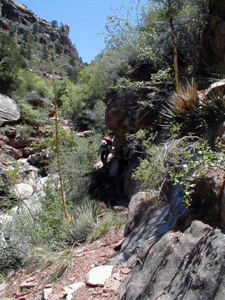
be? Martin exploring the upper narrows of
Saddle Canyon. The cool shade was welcome. Most of the walking was easy dry
rock. But some involved walking through pools
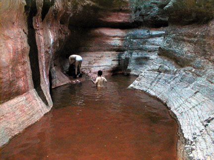
of water. The crew gets ready to photograph Bob
entering the water. We lowered our packs down a slope just to
the left of this slot. Chris gets ready to enter the water. How
deep is it? It was shin deep. Our hot, hardworking feet rejoiced in the
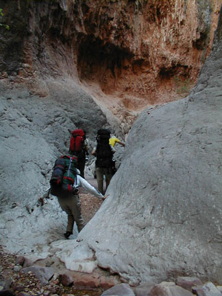
cool water. After wading in the water we pick up our
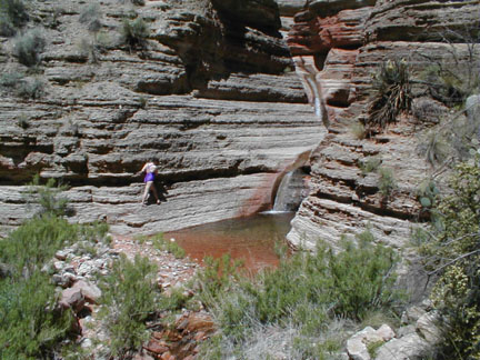
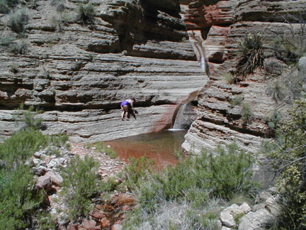
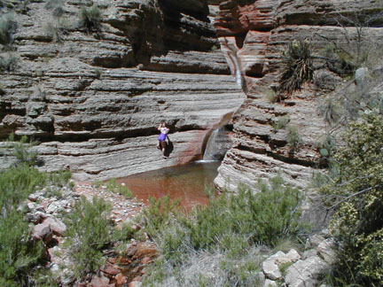
packs and head down the canyon. We were happy. This is what we came to
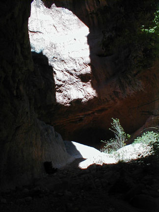
do. The exit of the narrows, we drank in
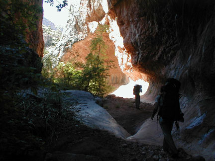
views of beautifully lit overhanging rock We're getting deeper in the canyon now.
The only two ways out are downstream, and back
upstream. Some of the drops were easy to
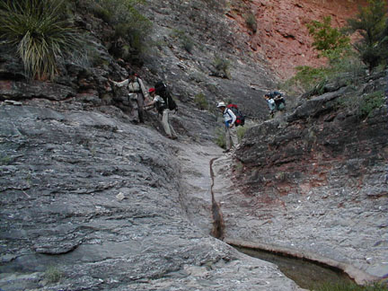
descend... Others were harder! When we came to a big pour-off we looked
along the right and left sides to find the easiest way
down. At one point we had to leave Saddle
Canyon to bypass the cliff of a huge pour off. A faint trail
climbed the west wall and went up to the ridge top. The the
trail followed the ridge to its end where it descended into
the next canyon to the west. We climbed under full pack in
the sun, it was hot going. We were glad when the side canyon
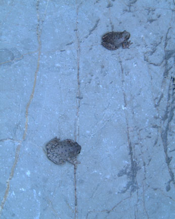
delivered us back to the floor of Saddle Canyon. Frogs keep their feet dry. These loud frogs sounded like bleating
sheep. We encountered a tremendous variety of
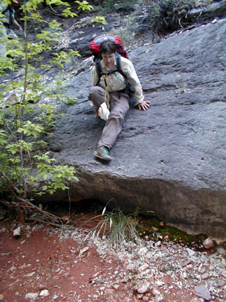
descents Hiking on clean rock was always better
than bushwhacking. Morresa slides down some smooth
rock. At the end of the trip Chris had several
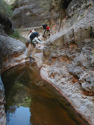
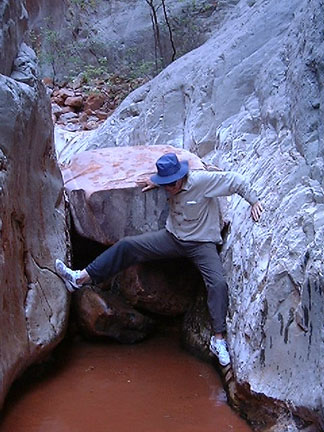
tears in the seat portion of his pants. Sometimes, chock stones block the canyon.
Pools of water beneath chock stones can complicated the
descent. This is the Chocolaty Pool beneath the
infamous slicky slide. The slide was steep narrow and wet. we
slid our packs down it and climbed down keeping our butts
out of the water. At the bottom we arrived at the
pool. We wrestled packs across chest deep cold
water, balancing them on our shoulders and heads, like
porters on a safari. The pool had a soft muddy bottom which
oozed between our toes and up our shins as we tried to stay
upright and keep the packs dry. Just in case, everything inside the packs
was encased in plastic bags. The water was cold and we got chilled in
the pool, so after crossing it we took a break to eat and
put on dry clothes. George Steck in his "Grand Canyon Loop
Hikes 2" reported making the full descent twice, once in 5
hours and once in 8 hours. (Although he didn't count his
lunch stop times) After 10 hours of hiking, counting lunch,
we were still in the canyon, George you are fast! Dusk came upon as we came to a high pour
off, we decided that descending it would be dangerous in the
dimming light so we stopped and camped on smooth flat Mauv
ledges. We kept an eye out for escape routes if there were
to be a flash flood. Looking downstream from camp
2. Bob and I went out to the end of the
steep gravel slope on the right, it ended at a
cliff. Martin went to the left and saw a wild
ledge that crossed the wall and ended at a talus
cone. Amazing! We'd see how hard it was in the
morning. We made our beds on flat smooth Mauv
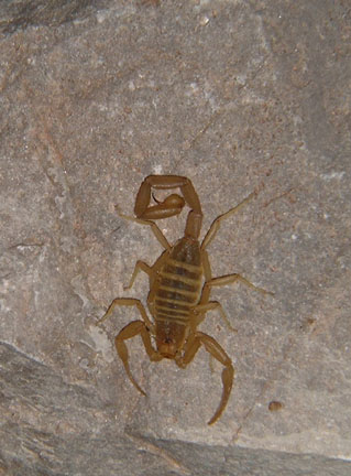
Limestone Ledges. A Scorpion which Chris found by his shoes
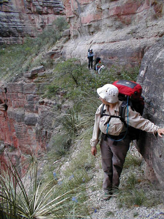
in the morning. Morresa hiking the improbable
ledge. Don't trip here! The ledge took us across a cliff and
ended conveniently at a pile of avalanche debris that
allowed us to descend to the floor of the canyon. The big pour-off. This is the cliff that was bypassed by
the improbable ledge traverse. Not everyone is sure-footed enough to
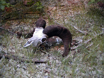
make it down the trail alive! The skull of a Bighorn sheep. We passed Stina canyon where George Steck
had camped and been caught in a flash flood, and continued
down the canyon in the cool of the morning. We enjoyed the canyon scenery and
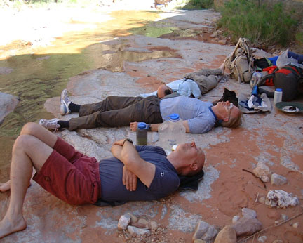
reflections. 100 F in the shade. Time to rest on flat Mauv ledges at
Camp3. We arrived at Crazy Jug canyon and paused
to swim in cool pools. Following the stream up Crazy Jug Canyon
we found more flat Mauv ledges and made our third campsite.
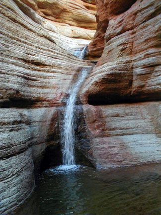
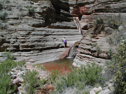
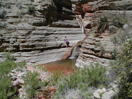
Above camp3 we found a superb set of
waterfalls and pools. A series of images showing Morresa
climbing along the cliffs to access the upper
pools. There's only one way to descend when a
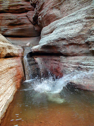
deep clear pool beckons you. Morresa does a cannon ball into the
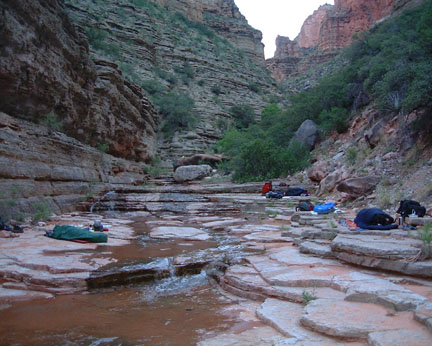
pool. The flat ledges of camp 3. We camped here for two nights. Bob had a new gravity feed water filter.
You can see it as the blue object hung from a distant
boulder. It saved us a lot of pumping. With a 6 foot "head"
it had a flow rate which was half the rate we could pump
water through our filter. It was great to sit back and let
gravity do our work. The next day was a rest day. We started hiking early when it was shady
and cool, heading for Tapeats creek. The route wound through shady forests
past pools of water and short cliffs. We couldn't reach Tapeats cave since the
spring flood of water filled the canyon wall to wall and
stopped us in our tracks. Morresa noted that she and Martin had
taken a whitewater rescue class and in an emergency they
could get us across the stream safely. We all noted that
this wasn't an emergency. Moressa also tested the water
temperature, she lost feeling in her leg after 20 seconds!
The water was cold! We turned around and hiked back to
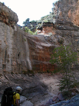
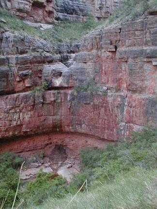
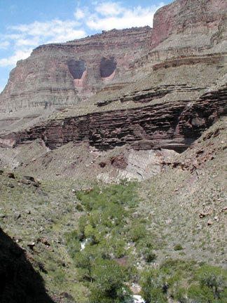
camp3. Here is a photo of The Great
Unconformity, just below where Tapeats Creek enters the
canyon. The tilted white layers up and right of
the trees. I got to hike on the top layer of the
unconformity, the Dox sandstone. I was truly caught by "geologist
bait." The Great Unconformity is a place where
erosion has removed hundreds of millions of years of
sedimentary history from the layers of the
canyon. Our camp3 was in the bottom left corner
of this image. In the cool of the morning Martin and I
explored the route out, up the wall. It was great to know we
could penetrate the Redwall limestone while wearing our
packs. On the descent, we marked the route with rock
cairns. In the late afternoon we all followed the
cairns with full packs. The packs had 3 quarts of drinking
water and 2 gallons of extra water apiece to allow us a dry
camp halfway to the rim at the esplanade. Unfortunately, the
water added 22 pounds to our packs! Bringing them up over 50
pounds total. We climbed up the slope behind the cliffs
in the middle left of this image. A narrow slot with a chock
stone boulder slowed our ascent a little. But loose slidy
rocks slowed us down even more. Near the top of the route. We wound our
way up through cliff bands. A second slot in the wall allowed us to
walk to the rim. Morresa was impaled by an agave thorn. It
broke off inside of her. Bob and I rushed to her aid and
with a safety pin and tweezers Morresa managed to get the
spine out! It was two centimeters long and impressively
large. To hike up the steep cliff under full
pack we all selected hiking sticks. Bob's stick broke when he tried to pry a
cactus out of his way, the broken stick gouged his palm and
blood flowed freely. We used the rope on top of my pack
briefly to rapell over a chockstone on the second day of our
trip. One person in the guidebook at the cabin
had signed in as a "Redwall Penetrator." We had now gone
through the redwall cliffs twice, once down once up.
We reached our campsite by 7:30 after 4
hours of climbing. We were all tired but not so tired that
we couldn't appreciate the glow of a wonderful
sunset. At 5 AM the next morning we watched the
International Space station pass overhead. Our dry campsite was in the saddle,
halfway from the canyon to the rim. We broke camp at 6 AM, then climbed up
through short cliffs of Supai sandstone. A few sparse cairns and a few old
footprints marked a route. Chris traversing a cliff in the Supai
Sandstone. Shortly after this photo he reached up
and grabbed a cactus. We made a short stop to remove spines
with tweezers. The best of walking the esplanade: clean,
flat rock. Shortly afterwards the route went to
hell. We followed some footprints to the right of my planned
route and ended up beneath Crazy Jug Point. Here we found a
half dozen gullies. The east wall of each gully was covered
with manzanita, agave, juniper and other bushes. We had
hard, hot going. The map offered no easy way out. We just
had to push on, through brush, up and down steep gulley
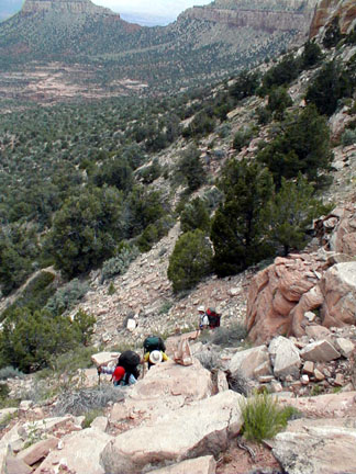
walls. At lunchtime we found two cairns marking
what we hoped was the route out. The cairns worked! They guided our climb
up out of the Tapeats Amphitheater toward the rim between
Crazy Jug and Monument points. The cairns guided us up
through the cliffs on an improbable route. It twisted around
a lot but we never had to remove our packs Bob had descended this trail 31 years
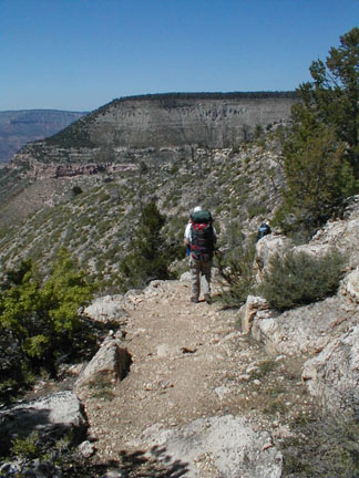
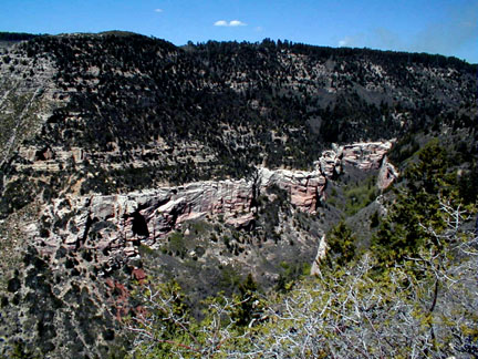
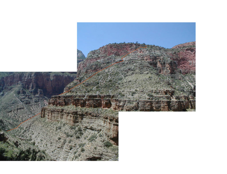
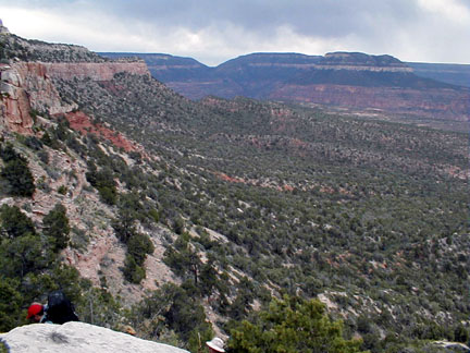
ago. It hadn't seen much use since then. Looking back at our route. We started at
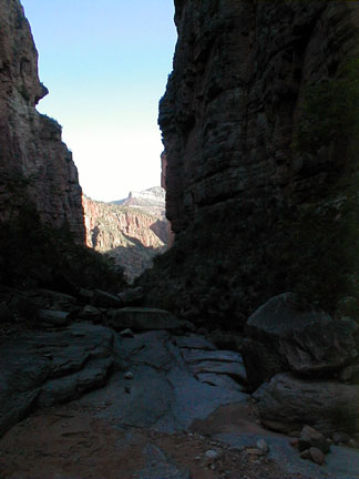
the distant notch, Mauv saddle. Luckily it clouded over in the afternoon
and kept us cool. The group at the end of the
trip. A little tired, but full of
adventure. Left to right, Chris, Bob, Morresa,
Martin, Paul. Bill is behind the camera. The white bandage on my face was what I
used as sunblock over my stitches. Returning to our cars we met the Prescott
Hot Shots, the fire crew had just finished putting out the
fire. We asked them about our cars, the fire
captain said that they were fine but that if the fire had
approached, the cars would have been towed to
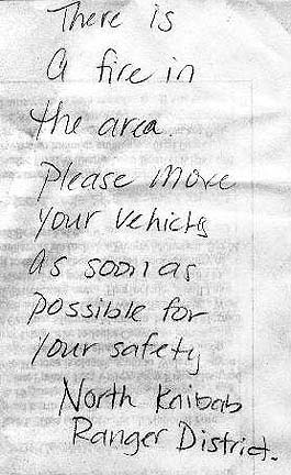
safety. Chris found this note on his
car.
The route was due south by the compass.
In the canyon, water is life.
The sign-in book inside the cabin registered only a couple
of parties each year.
And we were still on the trail! I wondered how few people
actually followed our off-trail route?
My guess is almost none.
We had avid readers with us. Morresa and Chris.
I was pleased to see that Chris was reading Nadya by my
friend and colleague Pat Murphy.
Everyone decided to push on into adventure.
The adventure started imediately.
The bushwhack down the saddle was indeed full of bushes, and
50% of the bushes had thorns.
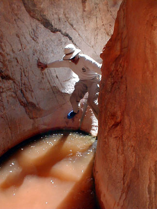
 Martin keeps his feet dry.
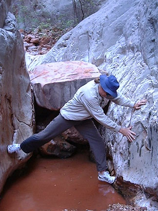 PD keeps his feet dry.
The water was cold! But that didn't stop our water spaniels:
Morresa and Chris.
Bob said he had finally figured out how to get a rest
day...plan two in a row...get one.
It was a delightfully cool and interesting walk.
There were places where a slip would have meant serious
injury. No one slipped.
If this wasn't the route out we would have a long walk to
our alternate exit the distant notch in the skyline beneath
bridger knoll.
Notice the multiple gullies in the foreground.
Here is the mnemonic for remembering the order of the layers in the Grand Canyon, top to bottom.
Kick Kaibab Limestone the Toroweap formation can Coconino Sandstone hard Hermit Shale some Supai sandstone rowdy Redwall Limestone may Mauv Limestone bring Bright Angel Shale the Tapeats Sandstone vodka Vishnu Schist
|
Scientific Explorations with Paul Doherty |
|
22 May 2001 |